CAD terrain export
Each CAD and BIM program prefers terrain in a different form. TOPOLUMA exports the same site as contour lines at their heights, as a triangulated surface or as an IFC site, so you can use whichever your software builds on best.
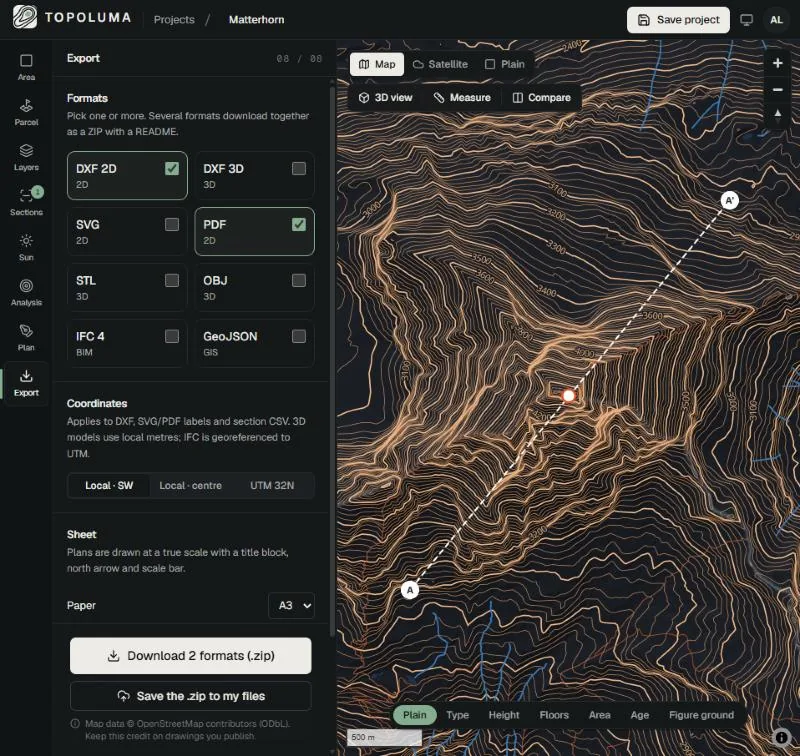
What you get
- AutoCAD and Civil 3D
- DXF 2D with contours as polylines at their elevation to build a surface, or DXF 3D faces for the terrain mesh.
- Revit and ArchiCAD
- IFC 4 with the terrain, buildings and a map conversion to UTM, or DXF contours to build a toposurface or mesh.
- Rhino, SketchUp and Blender
- OBJ in metres with terrain, buildings and trees as separate objects, Z-up or Y-up.
- Coordinates that line up
- Local metres from the south-west corner or the centre, or UTM (WGS 84), written down in the README in every download.
Who uses it, and for what
- Design base in CAD. Contours at their heights in AutoCAD, BricsCAD or Vectorworks to draw the scheme over.
- Surfaces in Civil 3D. A TIN surface built from the contour polylines for early grading studies.
- BIM site. A toposolid or mesh in Revit or ArchiCAD, from IFC 4 or from DXF contours.
How to do it
- Draw the area and generate the preview.
- In Export, pick the format for your program and the coordinates.
- Download; several formats come as one ZIP with a README.
- In your program, insert in metres: origin to origin for local coordinates, or at the UTM position.
Limits to know
DXF is written as R12 for compatibility, without hatches or dimension objects. Terrain detail follows the elevation source (about 30 m in most places). Read the workflow for your program in the guide before relying on the terrain for design levels. More on the data and accuracy page.
Questions
- How do I get the terrain into Revit?
- Either link the IFC 4 file (terrain mesh and context buildings, already placed), or import the DXF in metres, origin to origin, and create a Toposolid from the contours (Revit 2024 and later) or a Toposurface in earlier versions. The Revit and ArchiCAD guide walks through both.
- Should I export in local coordinates or UTM?
- Local coordinates (from the south-west corner or the centre) keep numbers small, which CAD programs handle best. Choose UTM when the drawing must line up with a survey or GIS data in the same zone; the README states the zone and its EPSG code.
- Why is the DXF written as R12?
- R12 is the most widely readable DXF version, so it opens in almost every CAD, BIM and GIS program. The trade-off is that it has no hatches or dimension objects.
- Can the exported terrain replace a survey?
- No. It is built from open elevation models, about 30 m in most of the world. It is a reliable base for context and early design, but levels you build to need a survey.